|
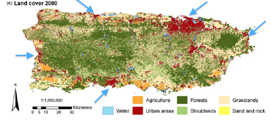
Approximately 11 to 14 percent of the island is considered to be composed of urban/built-up surfaces. Studies show that 60% of the current total development is relegated to the urban areas and is restricted to flat areas with a slope of less than 6 to 7%. These surfaces are mostly located in the coastal plains area, which is where the best agricultural lands reside.
The map to the right shows the type of land cover of Puerto Rico in 2000. as you can see the red areas which depicts urban areas is mostly located in the coastal plains |
|
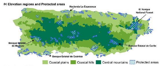
The map below shows the land classification from a topographic perspective as well as where the current protected areas are located. One problem with the El Yunque national forest is that the enforcement of its boarders is not strict enough and because of this some development is starting to encroach on its perimeter

|
This is do to the central mountains of Puerto Rico making most of the area unsuitable for development (there is some sprawl taking place in a couple of vales in the mountain range. With this restriction on land it is extremely important for effective use the widespread sprawl has been putting a strain on the agricultural land and currently negatively effects one quarter of this prime agricultural land
The Graph to the left depicts the loss of agricultural land and the increase in forested areas because of the abandonment of agriculture |
